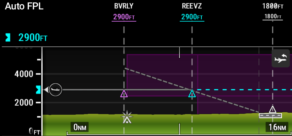
Airspace boundaries as defined in the Navigation Database can be shown on the VSD. Airspace symbols on the VSD reflect what is shown on other map displays in a vertical form. If the aircraft is within an airspace boundary, the airspace is displayed in semi-transparent shading. The VSD defaults to drawing airspaces as defined in 'Map Settings', with the additional ability for the pilot to enable/disable airspace viewing specifically on the VSD.
193: Airspaces on the VSD