NEXRAD (FIS-B)
The NEXRAD weather product cannot be displayed at the same time as relative terrain.
Pilots are encouraged to check additional NOTAM sources to supplement FIS-B NOTAMs. NOTAMs older than 30 minutes will not be displayed by FIS-B. For additional information refer to InFO 18008 and AC 00-63.
The ceiling for FIS-B is 24,000ft (FL240), however it is expected that users can receive the FIS-B service above that altitude. Some FIS-B products will only include data up to or near FL240, however Winds and Temps Aloft will extend up to FL390.
The National Weather Service (NWS) operates the WSR-88D, or NEXRAD (NEXt-generation RADar) system, an extensive network of 156 high-resolution Doppler radar systems. The NEXRAD network provides centralized meteorological information for the continental United States (CONUS) and selected overseas locations. The maximum range of a single NEXRAD site is 250 NM.
Individual NEXRAD sites supply the network with radar images, and the images from each radar site may arrive at the network at different rates and times. Periodically, the weather data provider to FIS-B compiles the available individual site images from the network to form a composite image, and assigns a single time to indicate when it created the image. This image becomes the NEXRAD weather product. Individual images--gathered from each NEXRAD site--differ in age, and are always older than the displayed NEXRAD weather product age. The data provider then sends the NEXRAD data to the FIS-B GBTs, which transmit this information during the next designated broadcast time for the NEXRAD weather product.
Because of the time required to detect, assemble, and distribute the NEXRAD weather product, the displayed weather information contained within the product may be older than the current radar synopsis and may not depict the current weather conditions. NEXRAD information should never be used as a basis for maneuvering in, near, or around areas of hazardous weather regardless of the information it contains.
The Map Application page on the MFW will only display CONUS NEXRAD Weather. Regional NEXRAD Weather information must be viewed using the Weather Application page on the MFW.
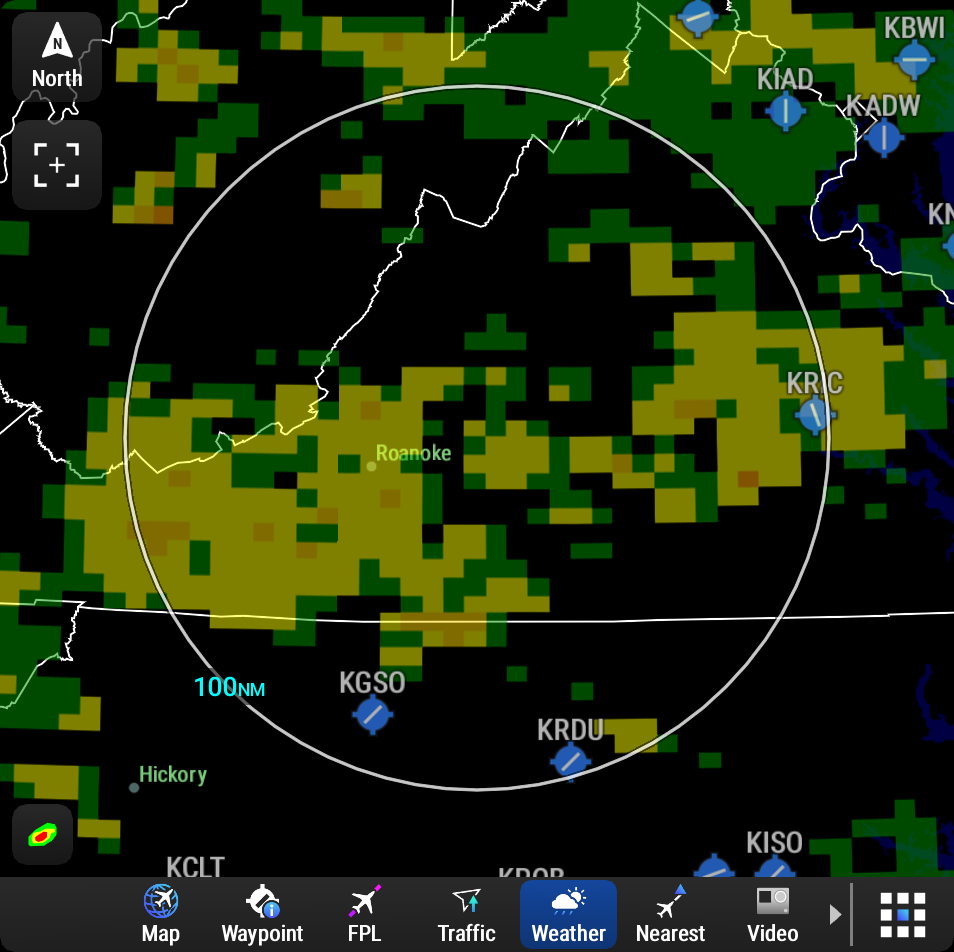
The Regional NEXRAD weather product coverage area varies, as it is determined by the data received from ground-based sources. When the Regional NEXRAD weather product is enabled, a white hatched boundary encloses this area to indicate the geographic limits of the Regional NEXRAD coverage being displayed. The system shows composite radar data from all available NEXRAD sites inside of this boundary area.


When NEXRAD is enabled, areas where radar data is not currently available, has not yet been received, or is not being collected are indicated in a gray shade of purple.
If the system has not received all available NEXRAD weather data (such as during initial FIS-B signal acquisition or in areas of marginal or poor signal reception), the system may display areas of no radar coverage which are subsequently removed as radar data is received. It may take up to approximately ten minutes to receive all FIS-B data, when adequate reception is available.