|
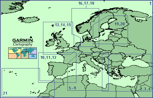
The
outlined numbered areas above represent the regions of
cartography coverage. Please refer to the corresponding
numbers below for a detailed map and listing of available
G-charts.
- Long Range Charts / Iceland
- Greece / Turkey - Large Charts
- Greece / Turkey - Medium Charts
- Greece / Turkey - Small Charts
- Mid Mediterranean Sea - Large Charts
- Mid Mediterranean Sea - Medium Charts
- Mediterranean / Tyrrhenian Sea - Small Charts
- Mediterranean / Sardinia to Libya - Small Charts
- Mediterranean / Adriatic Sea - Small Charts
- France West / Spain - Large Charts
- France West / Spain - Medium Charts
- France West / Spain - Small Charts
- U.K. / Ireland / English Channel - Large Charts
- U.K. / Ireland / English Channel - Medium Charts
- U.K. / Ireland / English Channel - Small Charts
- Norway / Denmark / Germany - Large Charts
- Norway / Denmark / Germany - Medium Charts
- Norway / Denmark / Germany - Small Charts
- Baltic Sea - Large Charts
- Baltic Sea - Medium / Small Charts
- Azores and Canary Islands
Acknowledgment:
This
product is produced, in part, from the products and with
the agreement of the hydrographic offices of the United
Kingdom, Denmark, Norway, Finland, and Italy. These hydrographic
offices have not verified this product and do not accept
liability for its accuracy. |