Data Pages
The data pages available on your device vary based on the device mode. In low power mode, GPS is disabled, and the device does not record data. In tracking mode, GPS is enabled and sensor data is recorded to the track log, but you are not navigating to a destination. In navigation mode, you are navigating to a destination.
|
Low Power Mode |
|
|---|---|
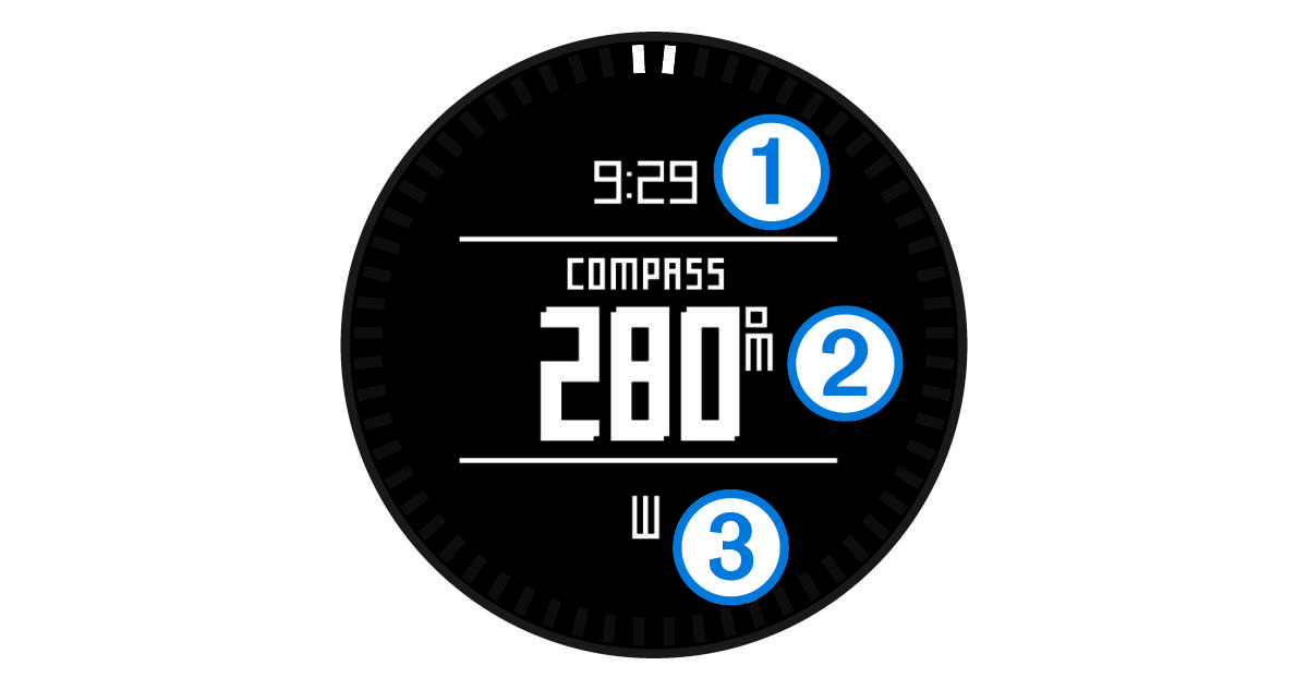 |
The compass page displays the time of day |
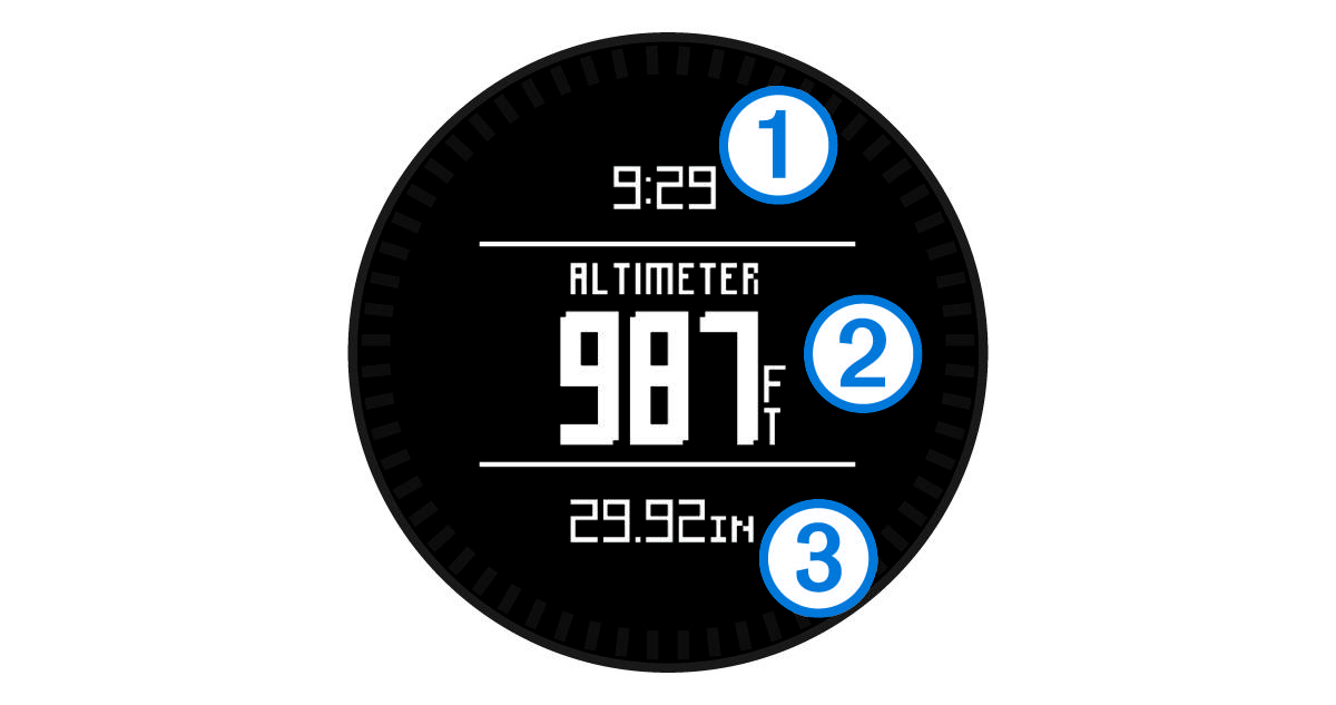 |
The altimeter page displays the time of day |
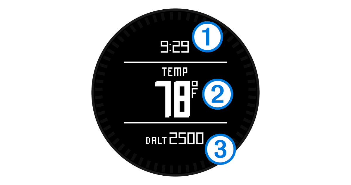 |
The temperature page displays the time of day |


|
Tracking or Navigation Modes |
|
|---|---|
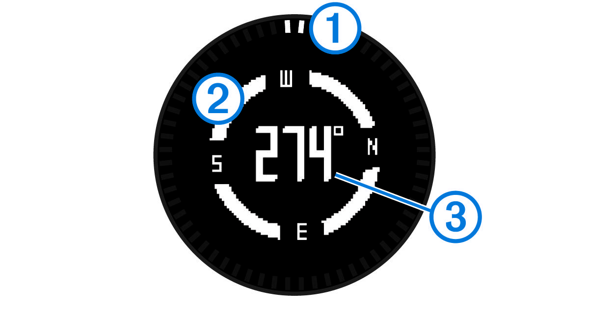 |
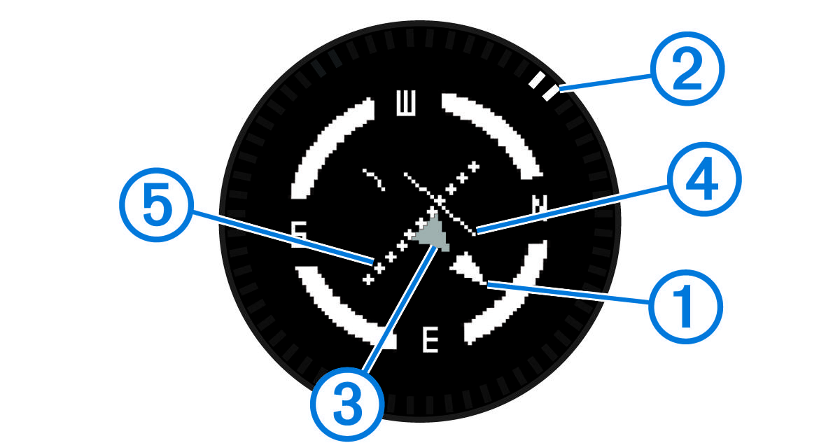
The compass page displays the bearing to the nearest airport |
 |
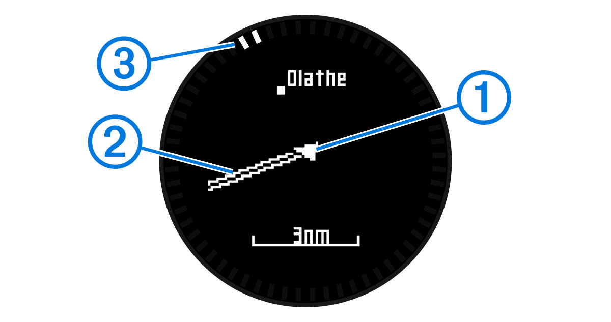
The horizontal situation indicator (HSI) displays the course line pointer |
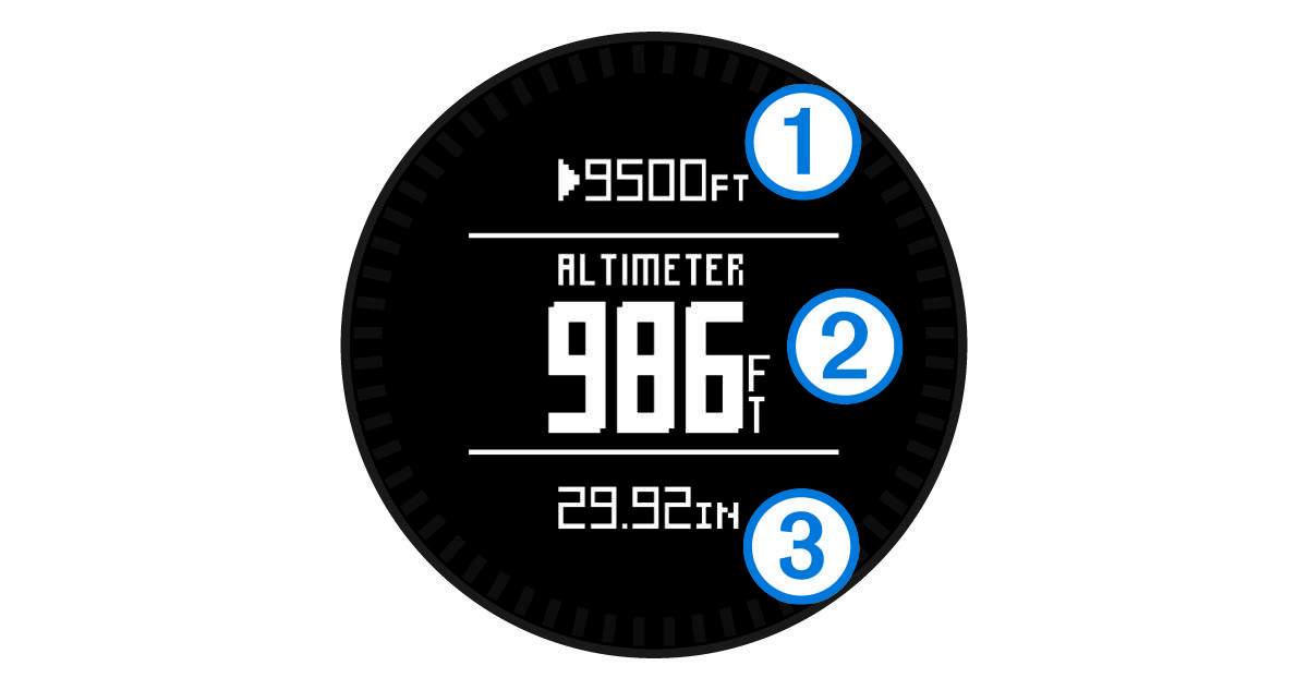 |
The altimeter page displays the alert altitude |
|
|
The temperature page displays the time of day |
 |
The map displays your current location and direction |
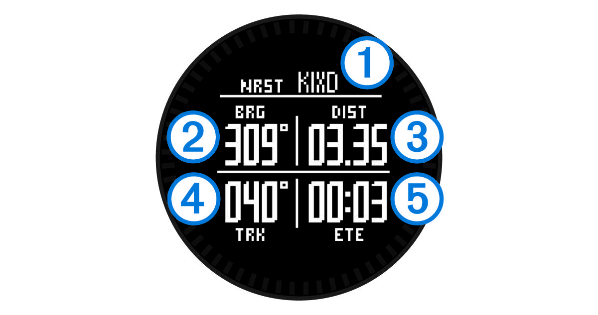 |
The nearest airport page displays the airport identifier |
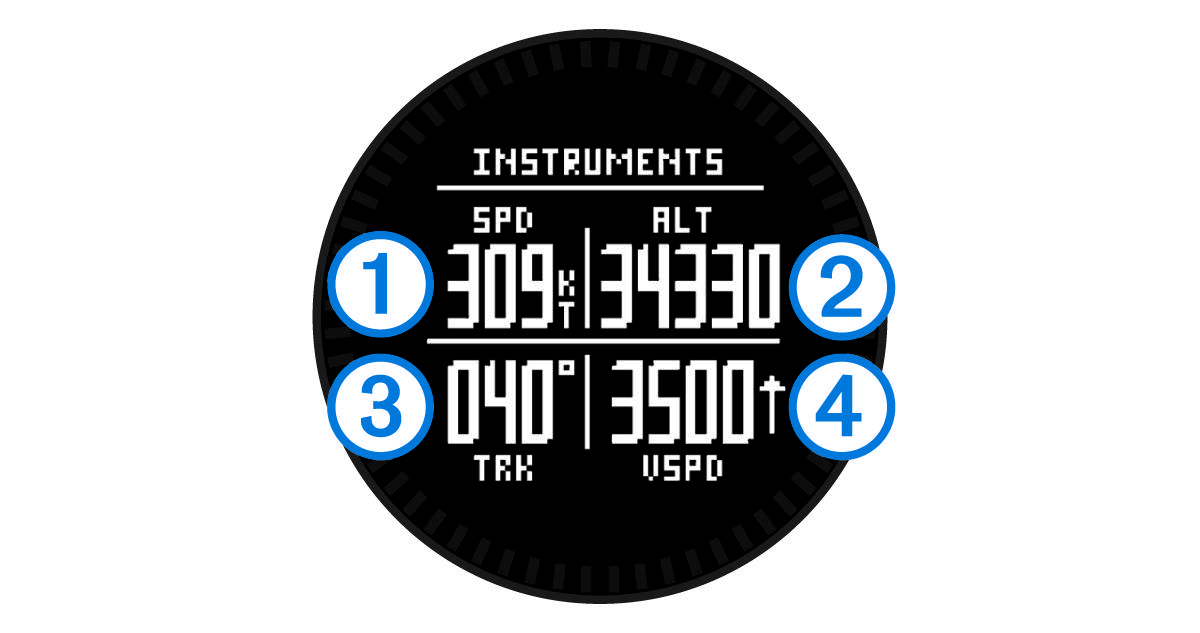 |
The instruments page displays your ground speed |
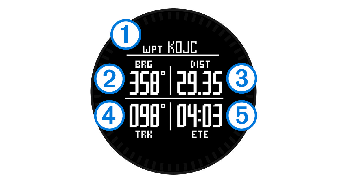 |
The next waypoint page displays the waypoint name |

