Map Range Autozoom
Autozoom allows the system to change the range to the smallest range clearly showing the active waypoint. Autozoom can be overridden by manually adjusting the range. The setting remains until the active waypoint changes, a terrain or traffic alert occurs, the aircraft takes off, or the manual override times out. Autozoom is suspended while the Pan Mode is active.
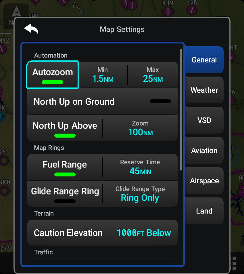
If a terrain caution or warning occurs, all map displays automatically adjust to the smallest map range clearly showing the potential impact areas. If a new traffic advisory alert occurs, any map capable of displaying traffic advisory alerts automatically adjusts to the smallest map range clearly showing the traffic advisory. When terrain or traffic alerts clear, the map displays return to the previous autozoom range based on the active waypoint.
The autozoom function can be turned on or off. Control of the ranges at which the autozoom occurs is done by setting the Minimum and Maximum Zoom distances to display based upon the aircraft’s ground speed.
-
Waypoints that are long distances apart cause the map range to increase to a point where many details on the map are decluttered. If this is not acceptable, lower the Maximum Zoom setting to a value that limits the autozoom to an acceptable range.
-
Waypoints that are very short distances apart cause the map range to decrease to a point where situational awareness may not be what is desired. Increase the Minimum Zoom to a value that limits the autozoom to a minimum range that provides acceptable situational awareness.
-
Flight plans that have a combination of long and short legs cause the range to increase and decrease as waypoints sequence. To avoid this, autozoom can be disabled or the Maximum/Minimum Zoom distances can be adjusted.